
NATURE
The Mont-rebei Gorge (El Pallars Jussà - La Noguera - Spain) natural space covers a surface area of about 600 hectares. It was purchased by the Fundació Catalunya-La Pedrera (for the period of Territory and Landscape Foundation) in 1999 with the aim of preserving its natural and landscape values. For the most part it is included within the natural interest space (PEIN) of the Montsec and it also borders on the Partial Nature Reserve of the Mont-rebei Gorge. In 14 Apri 2005, the Mont-Rebei Canyon has been declared a Wildlife Refuge.
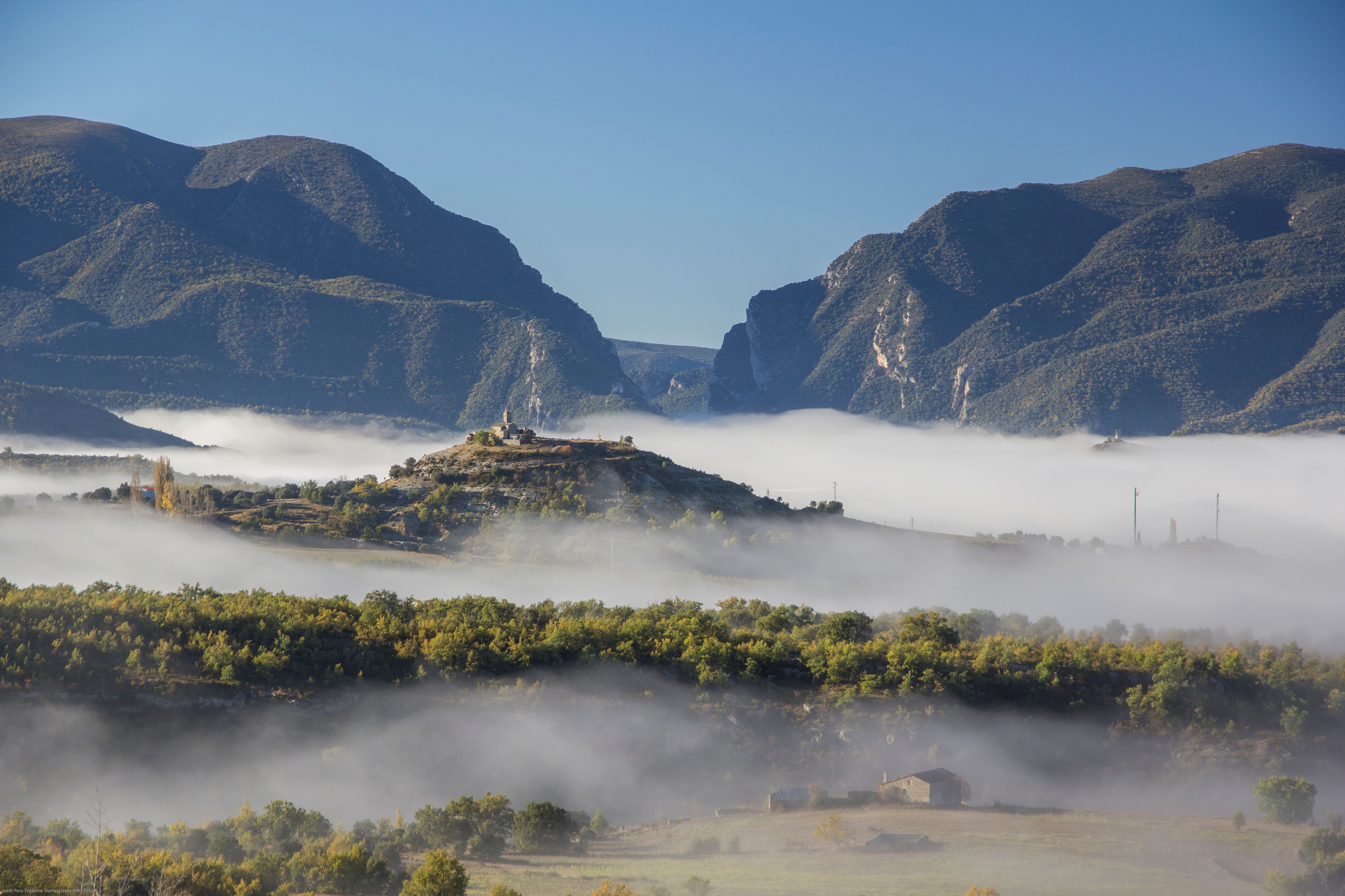
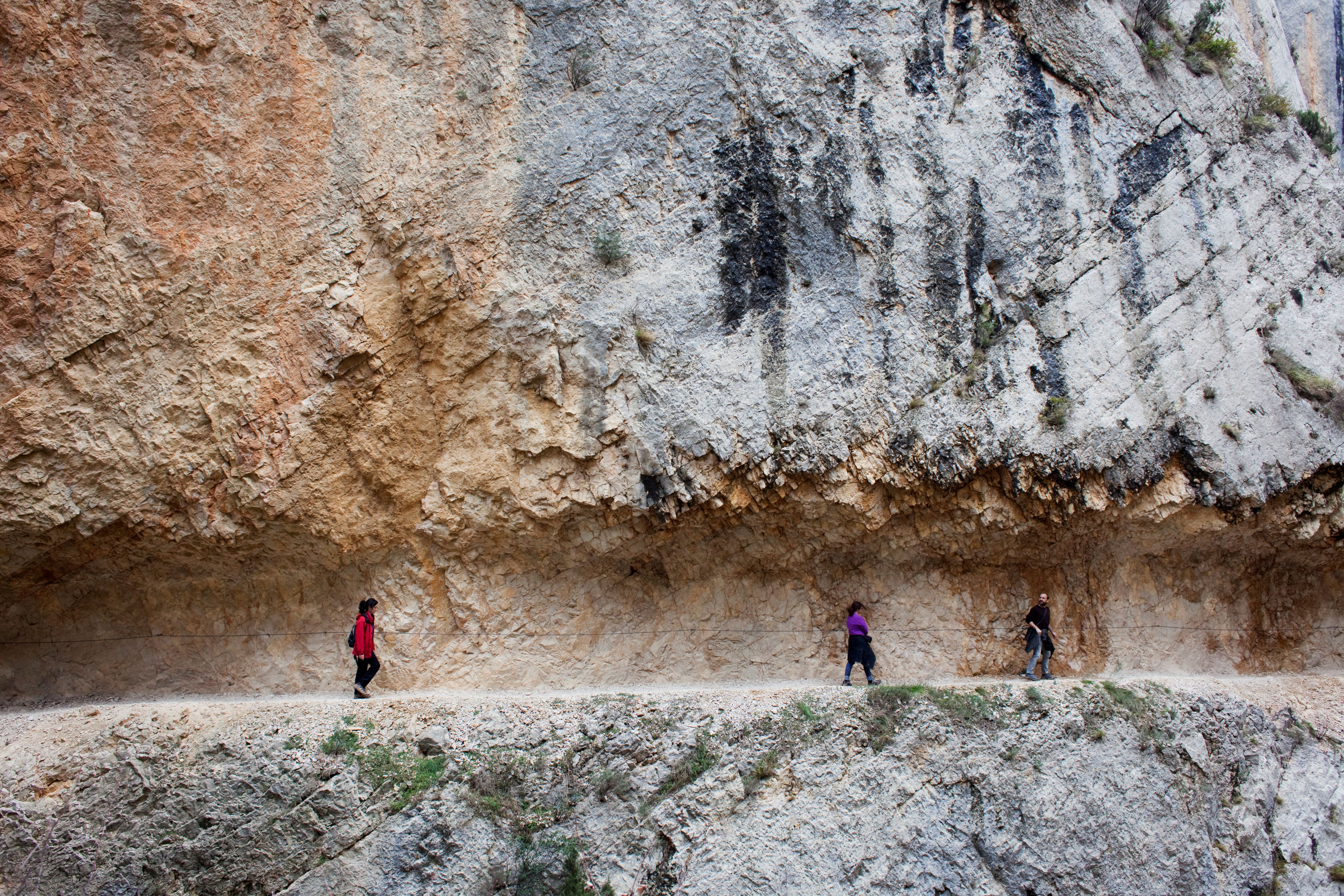
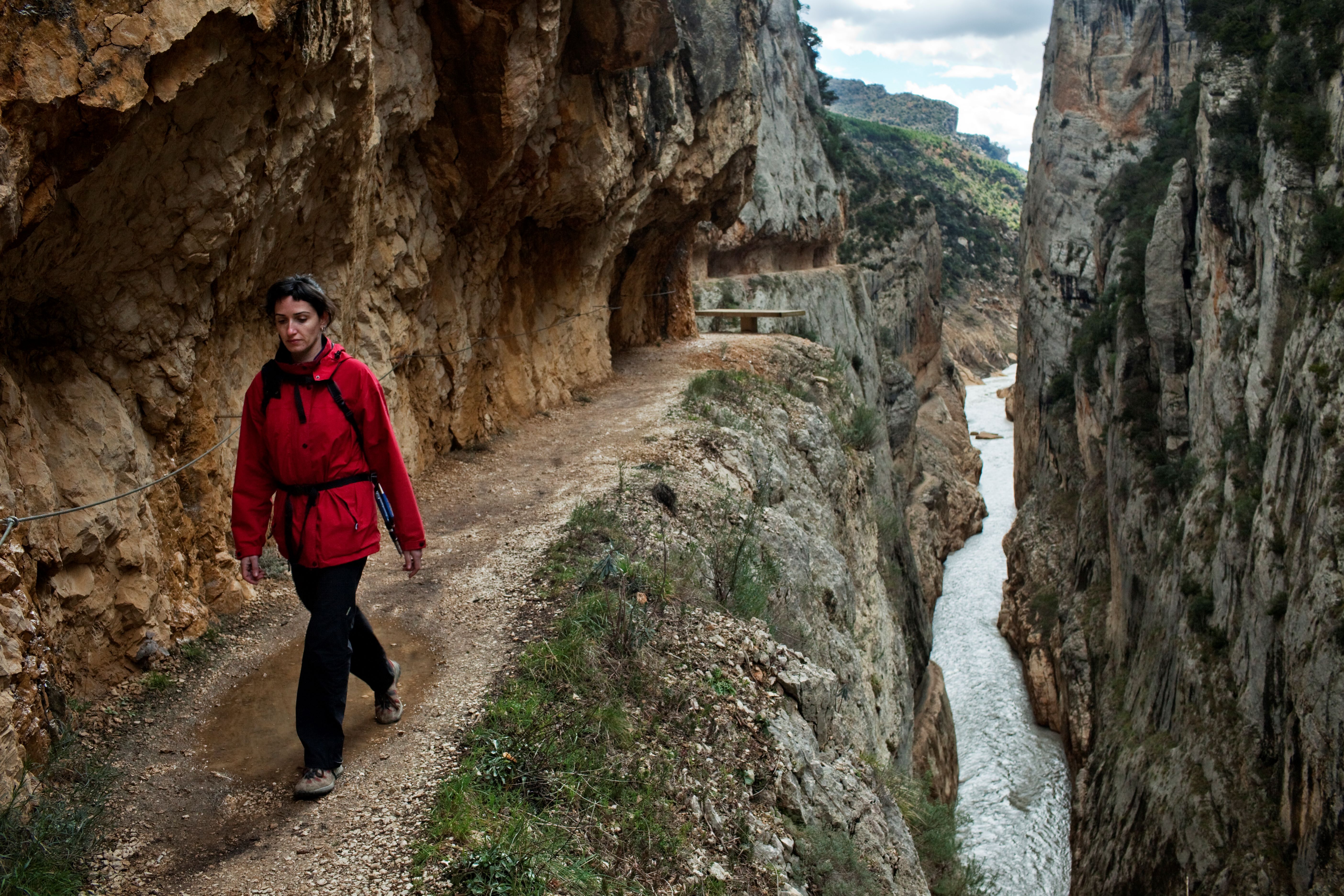
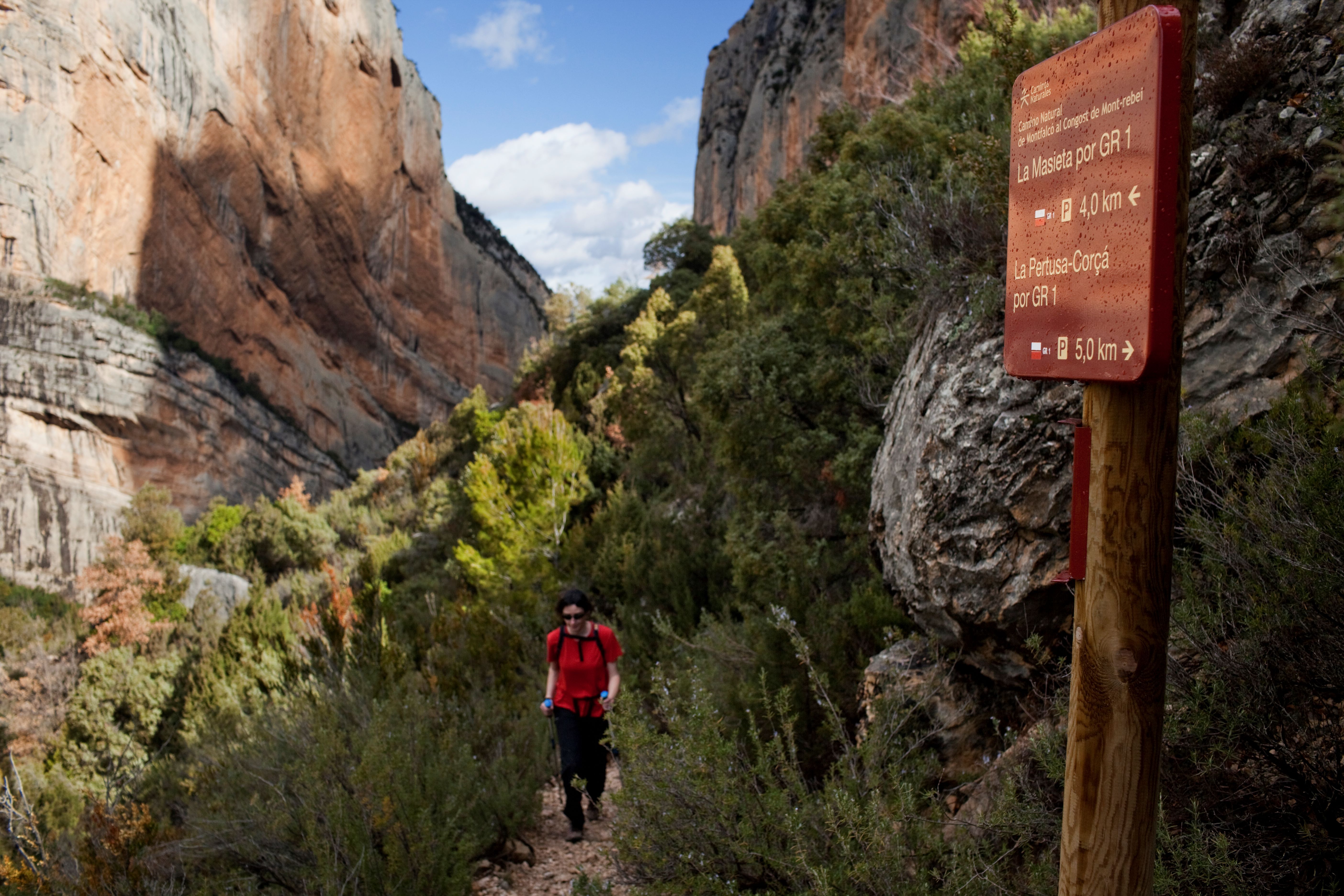
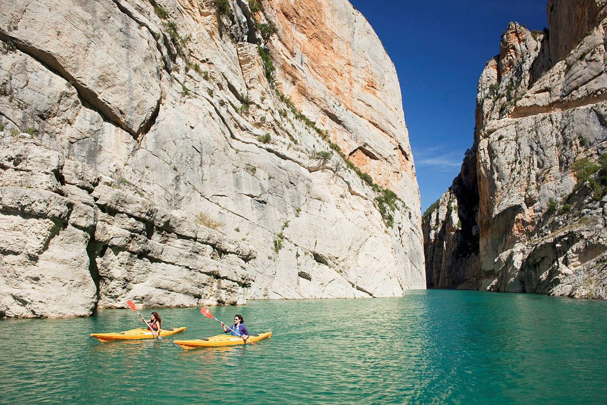
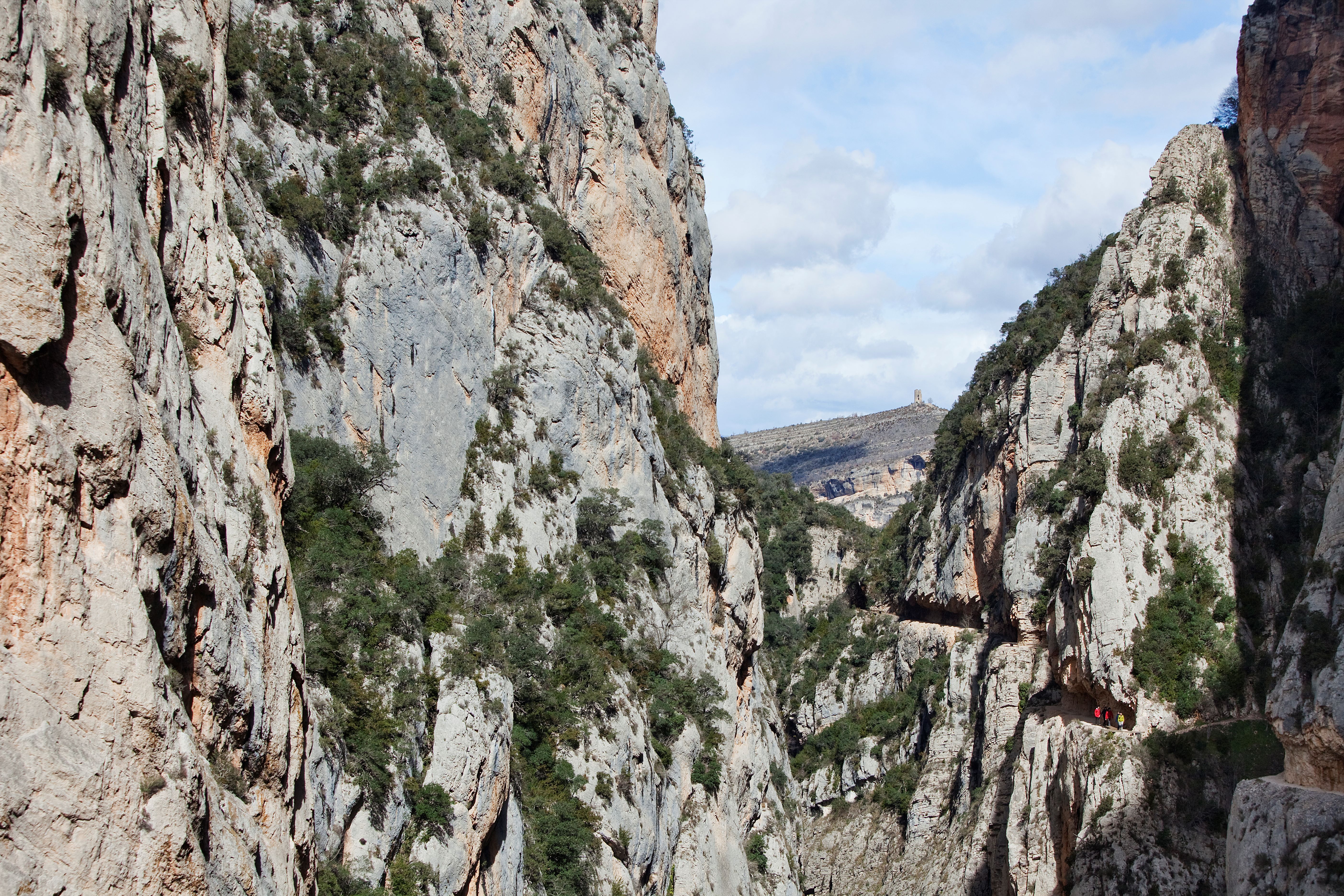
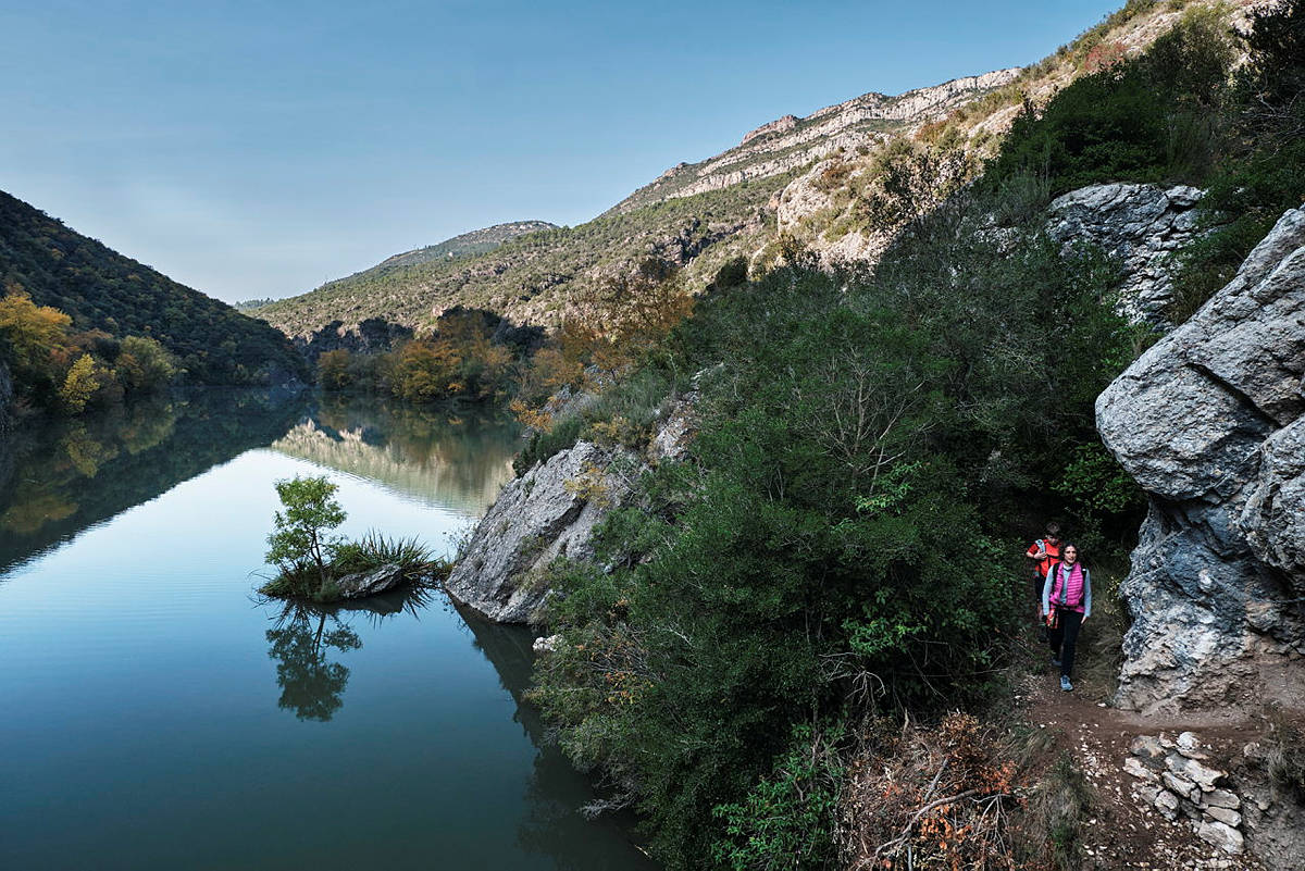
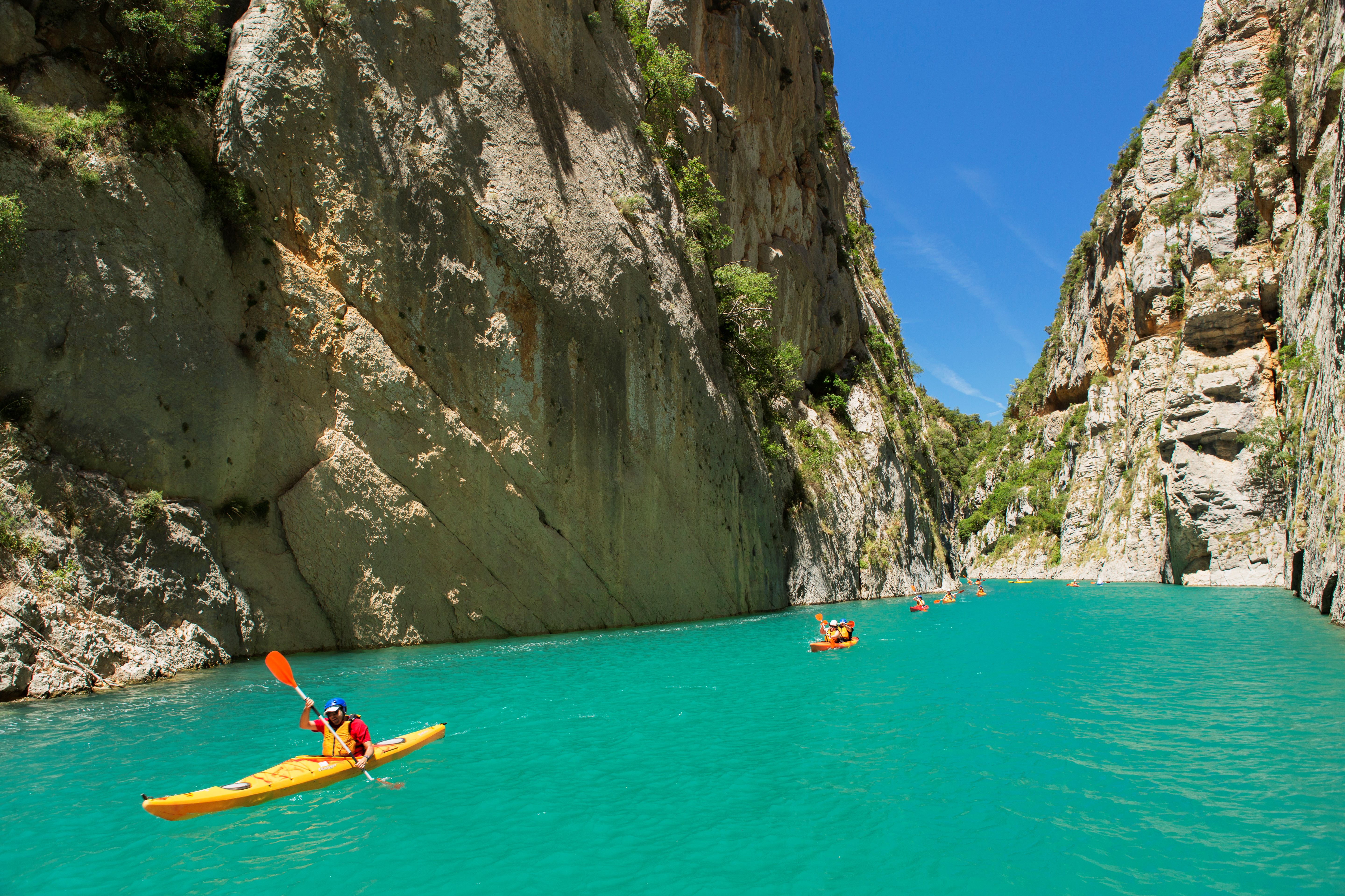
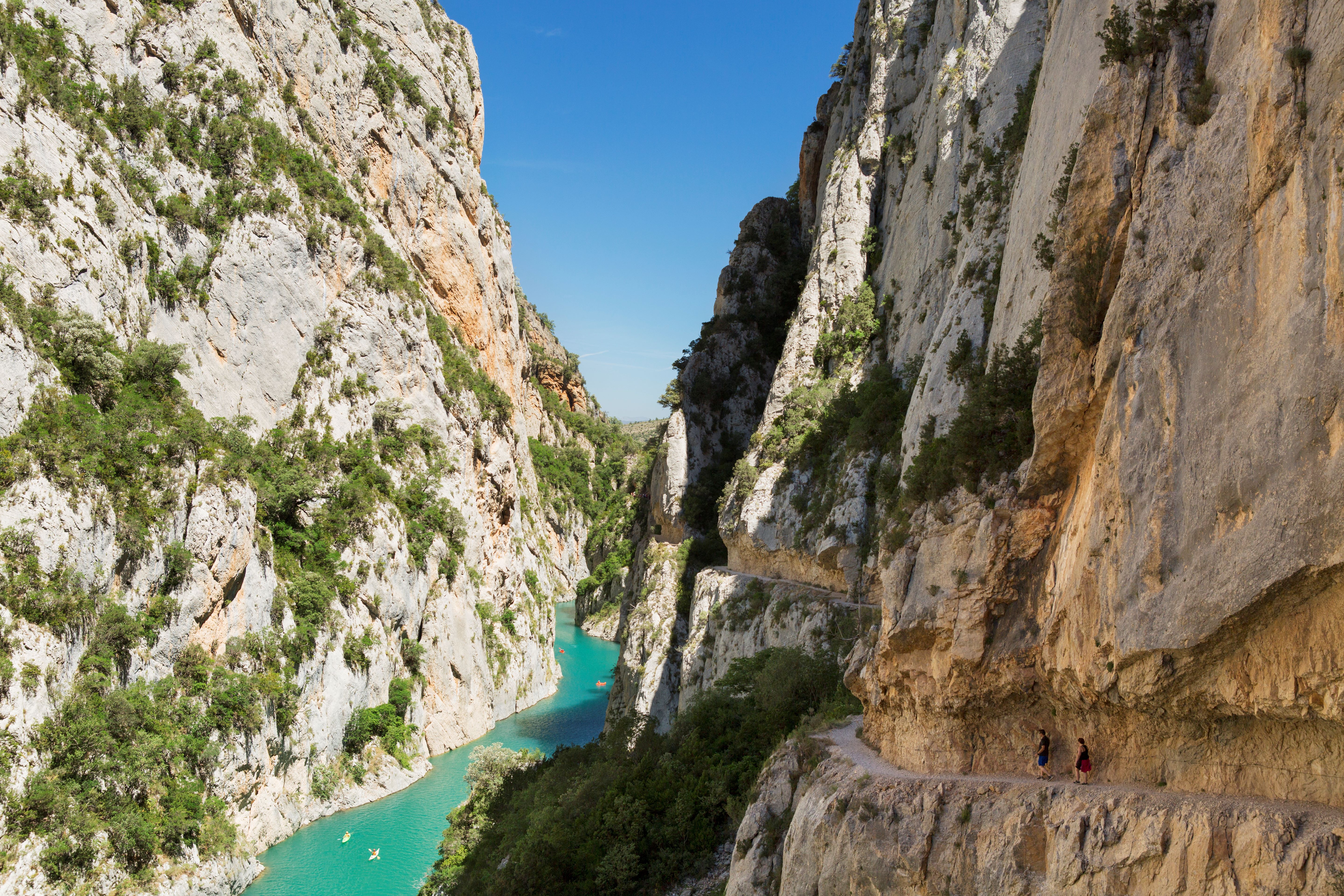
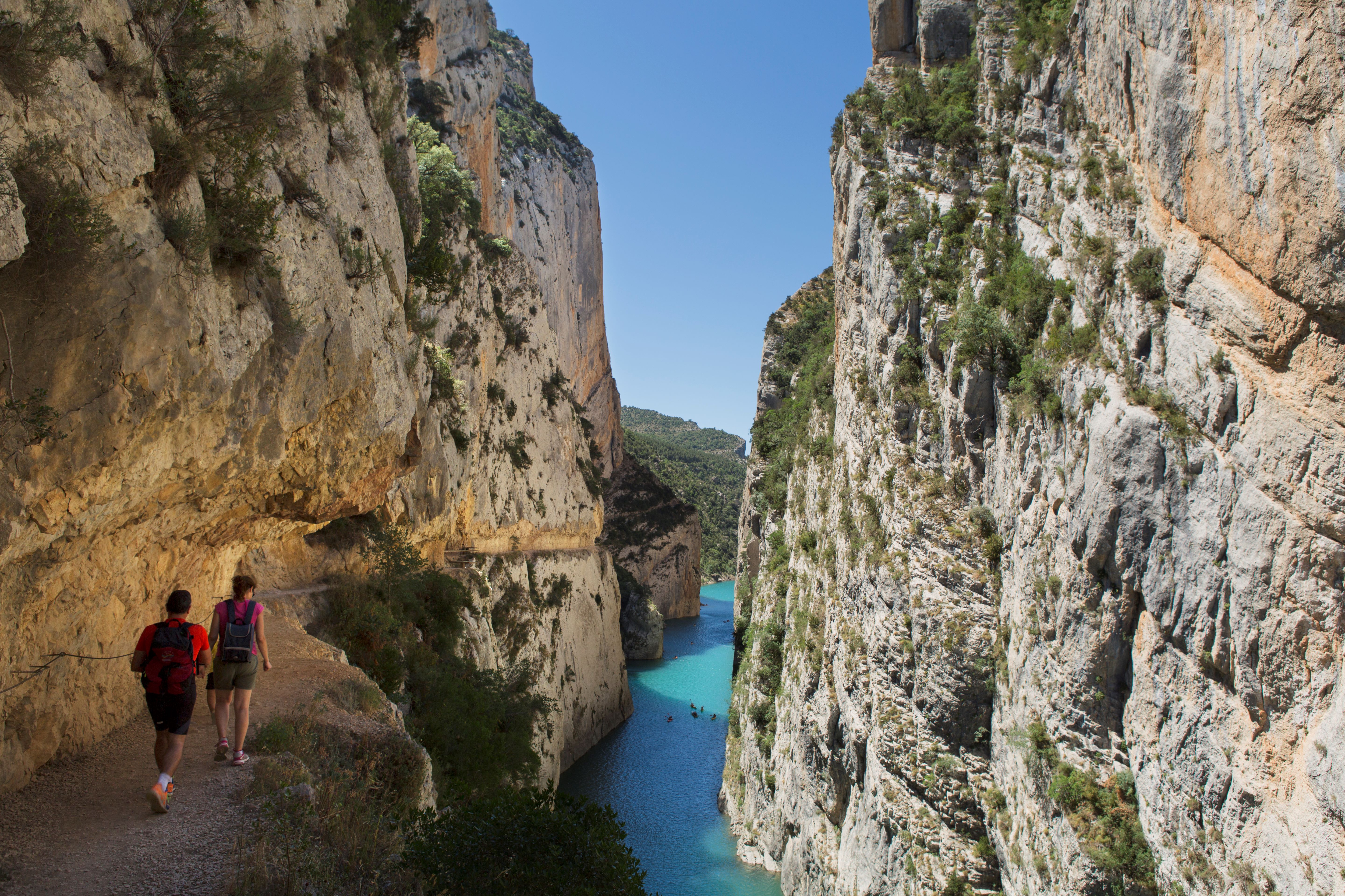
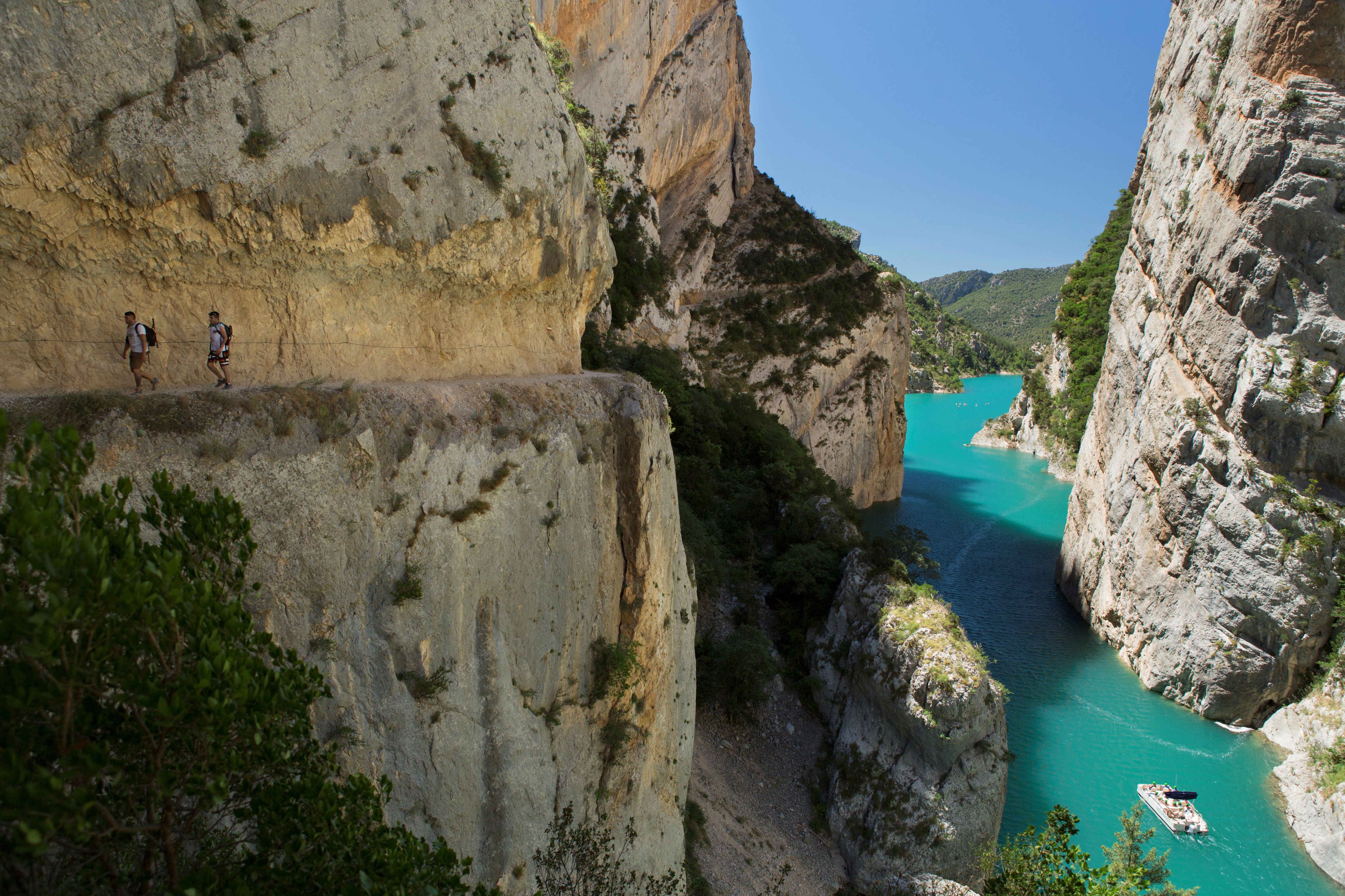
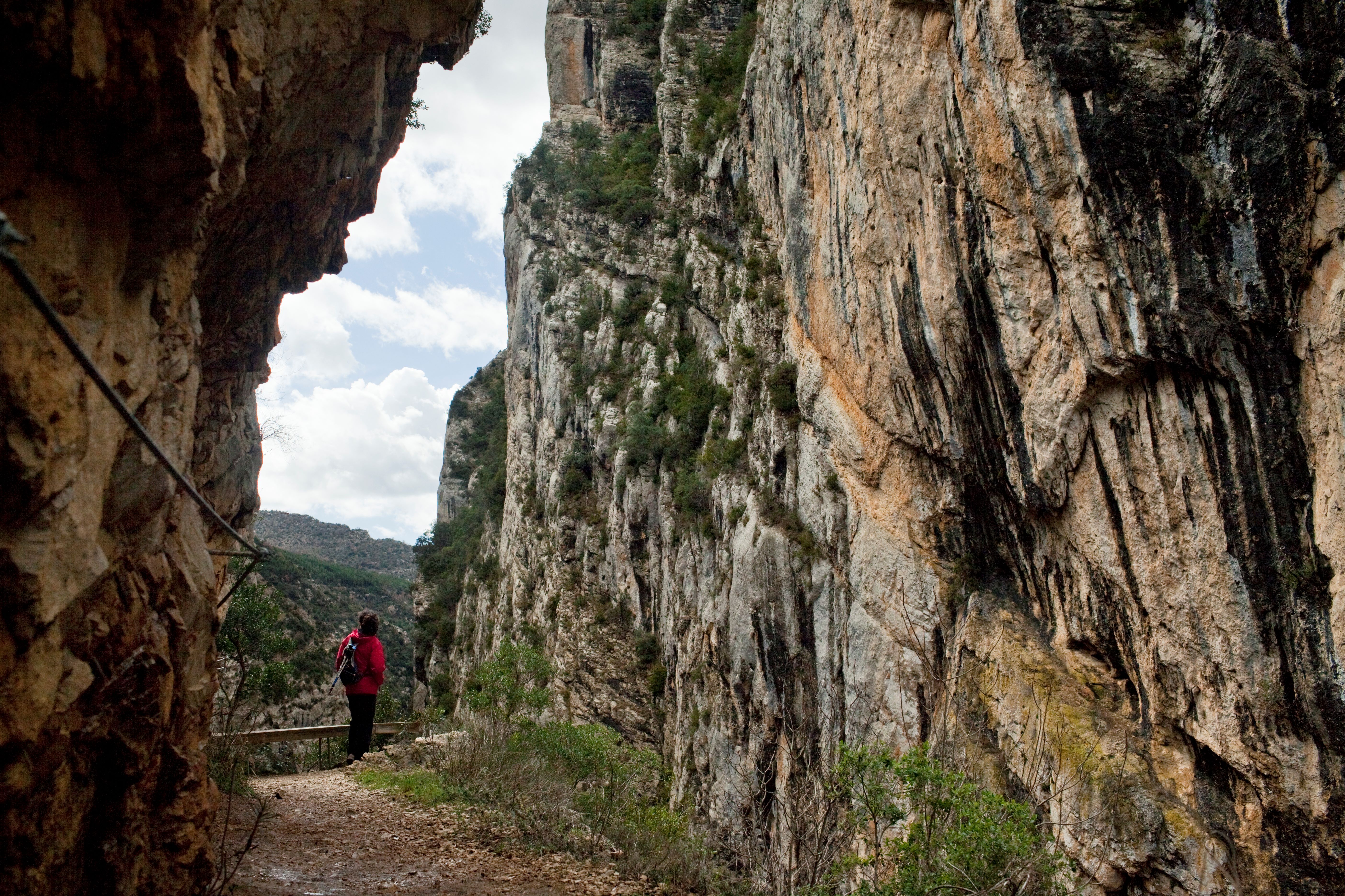
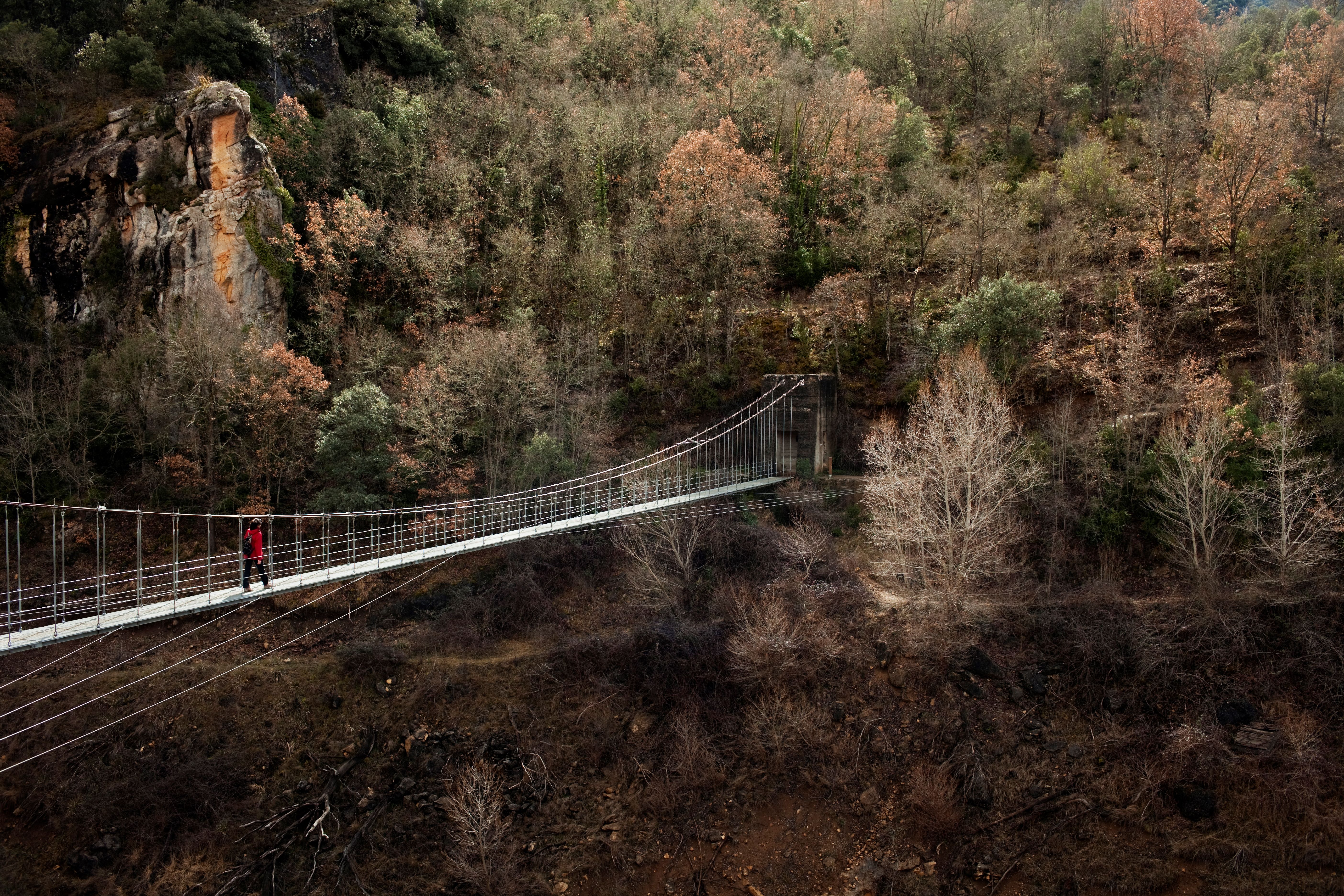
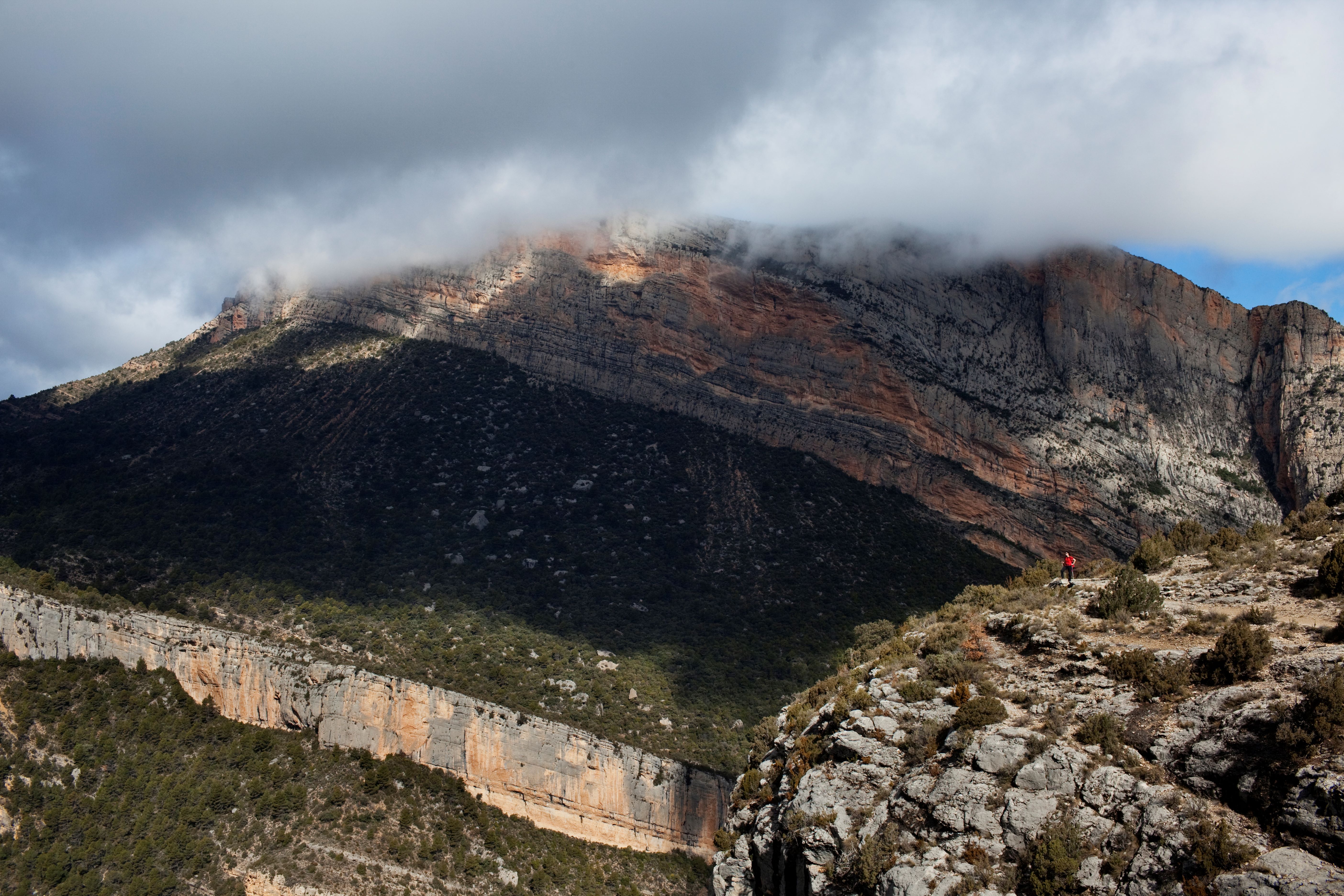
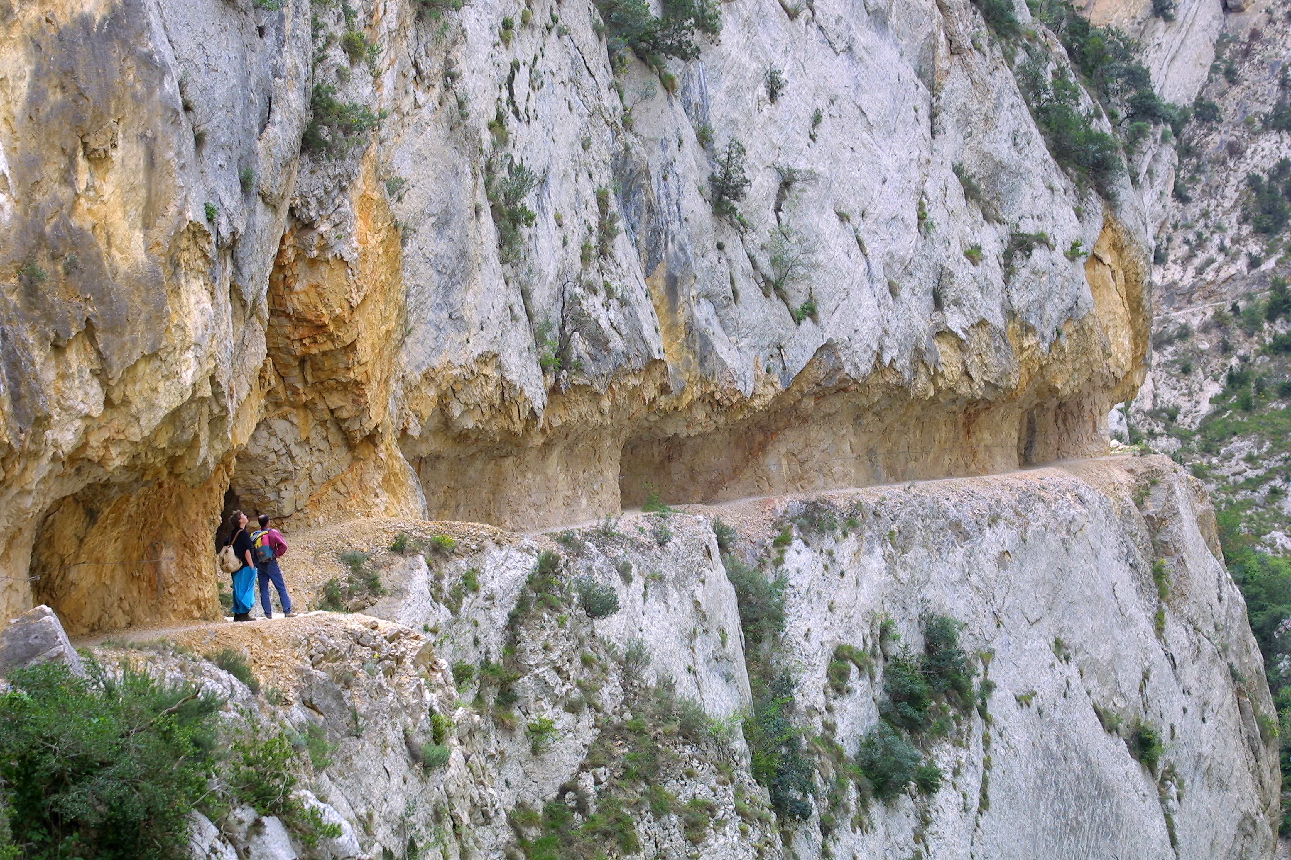
The Mont-rebei gorge, created by the river Noguera Ribagorçana as it passes throughthe Montsec mountains, separating the Montsec d'Ares from the Montsec de l'Estall and is the only great gorge in Catalonia (Spain) which has been kept more or less intact without being crossed by any road, railway or electricity line. It is only crossed by a mule track partially dug out of the rock, allowing this spot to be enjoyed in a very spectacular manner. The walls of the gorge reach vertical heights in excess of 500 metres at points where the minimum width of the gorge is no more than 20 metres.
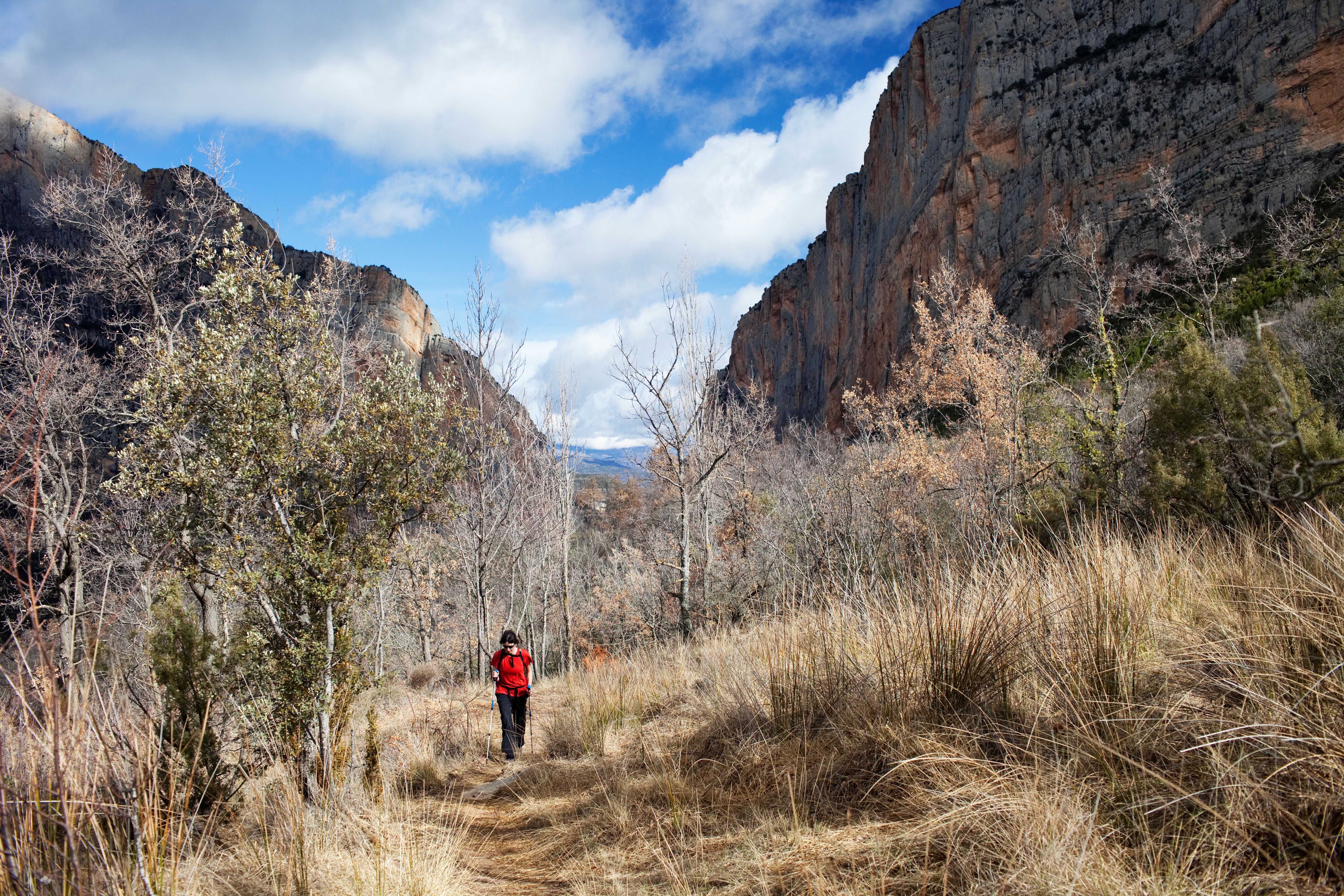
The vegetation of the gorge is marked by its altitude zoning and orientation. Two zones coexist: the southern slope, dominated by Mediterranean vegetation: oak trees, garigue, undergrowth and dry prairies, and the northern slope, which is dominated by euro-Siberian vegetation of a sub-Mediterranean nature, with a prevalence of small-leaved oak groves and common oak groves.
Several endemic species deserve mention, such as the extremely rare Petrocoptis monsticciana , as well as certain others: Saxifraga longifolia, Ramonda myconi, Erinacea anthyllis, the beech (Fagus sylvatica), the Holm oak (Q. ilex ssp. ilex), the oak (Q. ilex ssp. rotundifolia), the bearberry (Arctostaphlos uva-ursi), the black maple (Acer monspesulanum), the common maple (Acer campestris), the juneberry (Amelanychis ovalis), the hawthorn (Crataegus monogyna), the rough cinquefoil (Aphyllantes monspeliensis), the common lime (Tilia cordata), etc.
As for amphibians and reptiles, the most interesting species are the following: the Pyrenean (Euproctus asper) the Iberian viper (Vipera latasti), and the Pyrenean viper (Vipera aspis).
Within the bird group there is an abundance of the great birds of prey, which are typical of the cliffs: the bearded vulture (Gypaetus barbatus), the Egyptian vulture (Neophron pernopterus), the vulture (Gyps fulvus), the golden eagle (Aquila chrysaetos), the peregrine hawk (Falco peregrinus), as well as the alpine chough and chough (Pyrrhocorax graculus and P. pyrrhocorax) and the wallcreeper (Trichodroma muraria). Among the mammals we must mention the otter (Lutra lutra), the wild cat (Felis silvestris), the pine marten (Martes martes), the roe deer (Capreolus capreolus), the mole (Talpa europaea) and many species of bats.
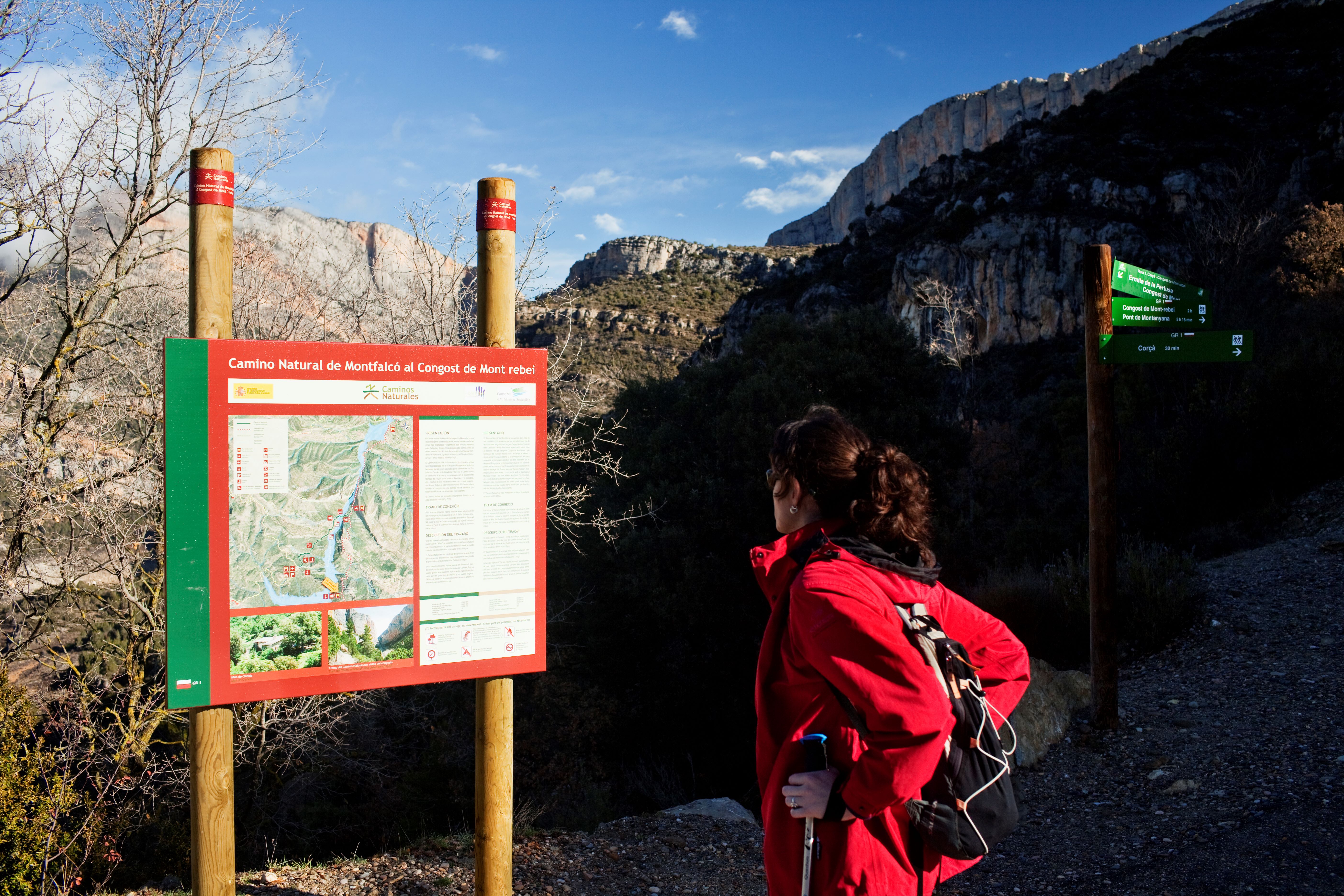
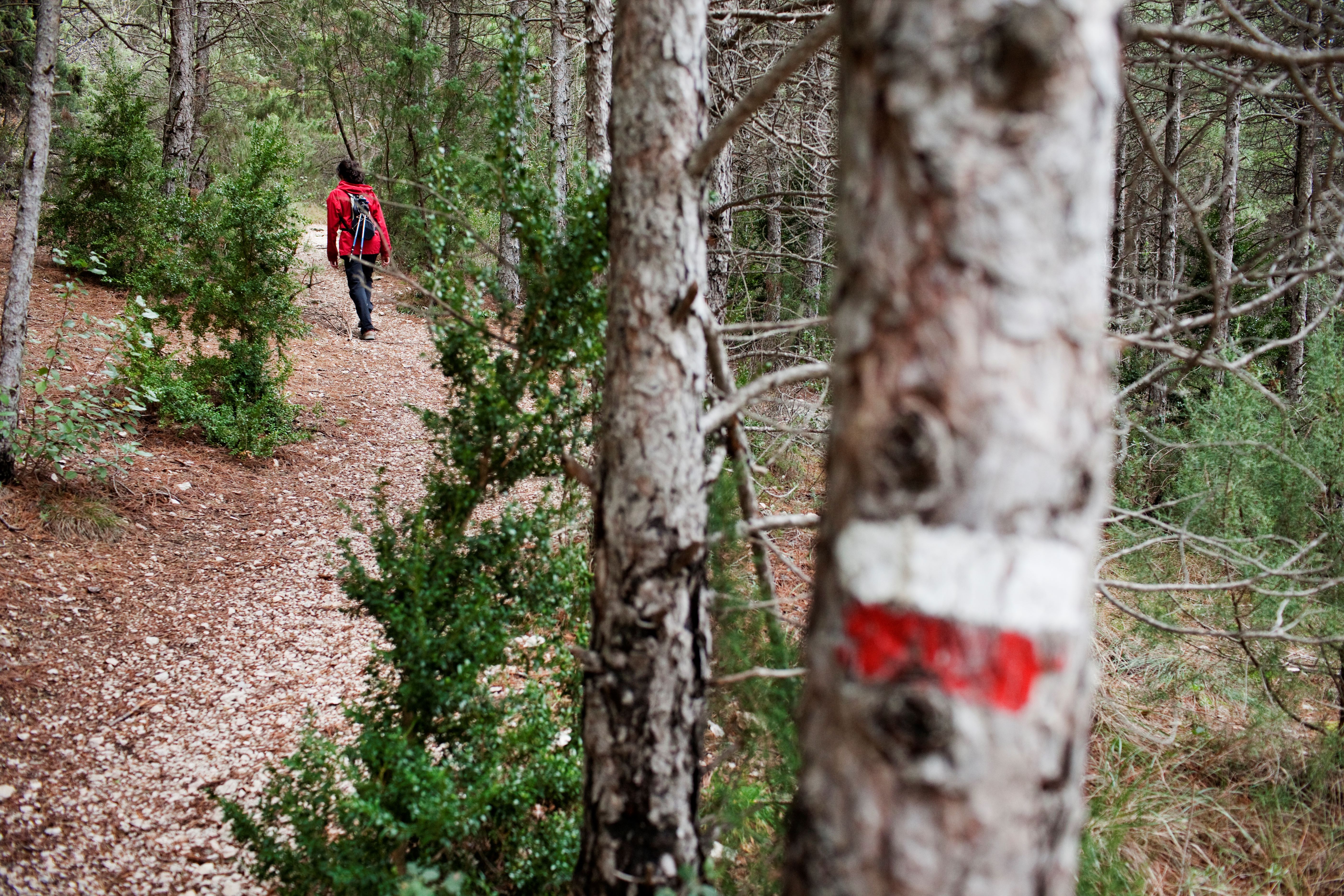
The easiest access for vehicles is the Pont de Montanyana. The path that crosses the gorge must not be missed due to its spectacular nature and beauty. We recommend accessing the inner part of the ravines using the proposed routes.
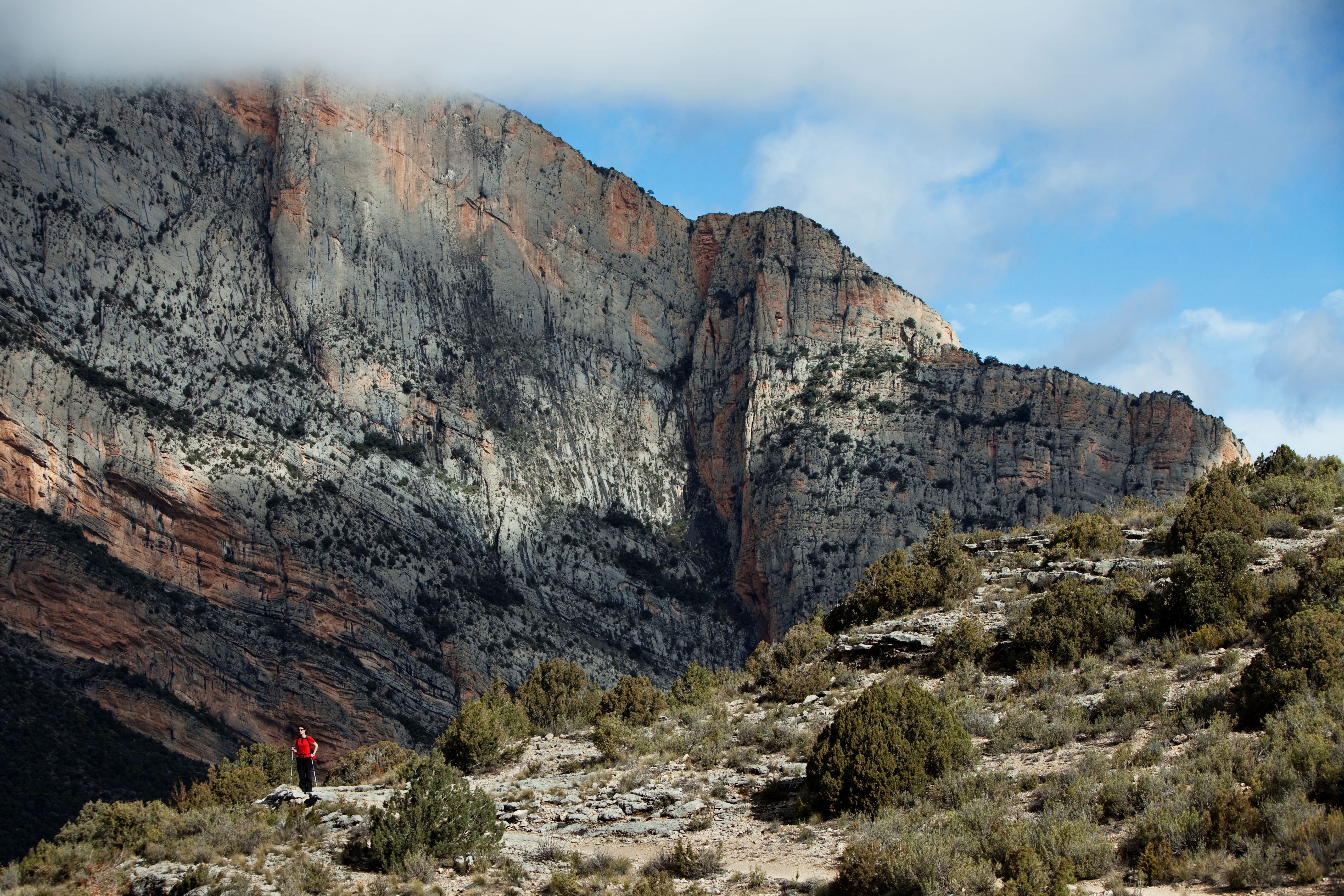
To access the top of the reserve and Montsec, from where a scenic view of the Pyrenean, part of La Ribagorça and the Lleida Depression, if you do not want to walk, you can get there by the track of Coll d'Àres (between Àger and Sant Esteve de la Sarga).
A scenic view of the whole reserve can be seen from the natural viewpoint made up of the curve in the track above the river Noguera Ribagorçana, which leads to Alsamora just before La Masieta, from where you can see the river's rapids before it enters the gorge, the chapel of Mare de Déu del Congost and Xiriveta Castle.
If you decide to visit this protected natural space, we recommend that you get information and reserve parking in advance at www.congostdemontrebei.cat
Rock climbers, remember that you will be sharing the walls of Mont-rebei with vultures and other rock birds. From December to June they are in the laying season; avoid rock-climbing in these dates. To open new channels and for further information, please contact the Foundation (info@congostdemontrebei.cat) or the Fauna Protection Service of the Department of the Environment (93 567 42 00).
Contact information
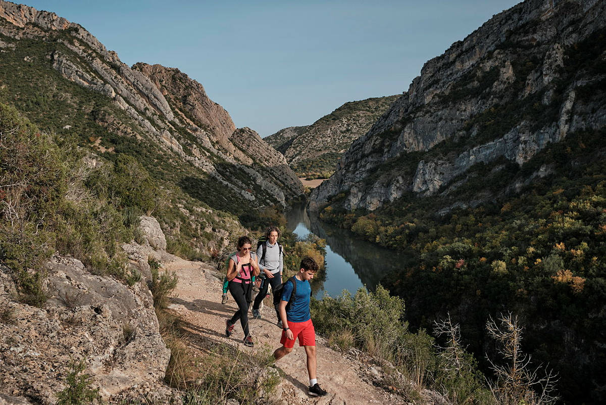
This is the classical Mont-rebei path (GR-1). It is about 4 km long and takes about 4 hours, 2 hours there and two back. Perfect for an all-day trip. The path runs down a very smooth slope and enters the gorge; after crossing the gorge you may prolong your walk by a steady, moderate climb to Carlets Farmhouse. Be careful in the gorge sector: it is not suitable for people with vertigo or who are not used to heights. By car, the furthest you can go is to the Masieta area (car park). You may choose either to undo the same path (2h) or to continue across towards the area of the Mare de Déu de la Pertusa and Corçà (another 2h 30 mins).
The route is 2 km long, and takes about 3 hours there and back. It can be easily done in half a day. The path is a climbing track from an altitude of 500 m to 900 m. You must take the path that leaves the car park to the south, towards the Mont-rebei gorge, and after crossing the Maçana ravine, where you will find the metal hanging bridge, you can continue the path for about 50 m, swiftly climbing out of the forest to a ledge (Altamiris) from where you will get a good view of the entrance to the gorge. After this point is the start of the path towards the east, where the Obaga Gran path descends until it meets the next Route.
The route is about 2.5 km long and takes about three hours. Leaving the car park, you must take the path towards the gorge by the path to the Tarteres. After crossing the first ravine, Jullanes, not very frequented, you must take a track that climbs up to a hill where there are some ruins. This is the starting point for the Carboners path, to the East, which goes into the sunny side of the Maçana ravine. From a rocky rise you can see the whole shady side and the low path, which first crosses the Maçana ravine and then a second ravine, where it joins route 2.
Around 6 hours. Perfect for a whole-day trip. The path has a variable slope, with some sections that climb and others that slope down moderately and very steeply. The route leaves the village of Alsamora towards the gorge and crosses several ravines on the shady side until it meets the end of route 2, at the height of the former fields of Lo Queixigar and Altimiris. We recommend walking down the Altimiris path (no. 2).